
Elevation correction
How to correct GPS elevation data on Android
This guide came from a real saved route where the recorded altitude made the climb total and profile less trustworthy than the route itself. GPS Logger can correct saved track elevations against terrain data, giving walkers, hikers, cyclists and field users a cleaner elevation profile and more realistic elevation gain.
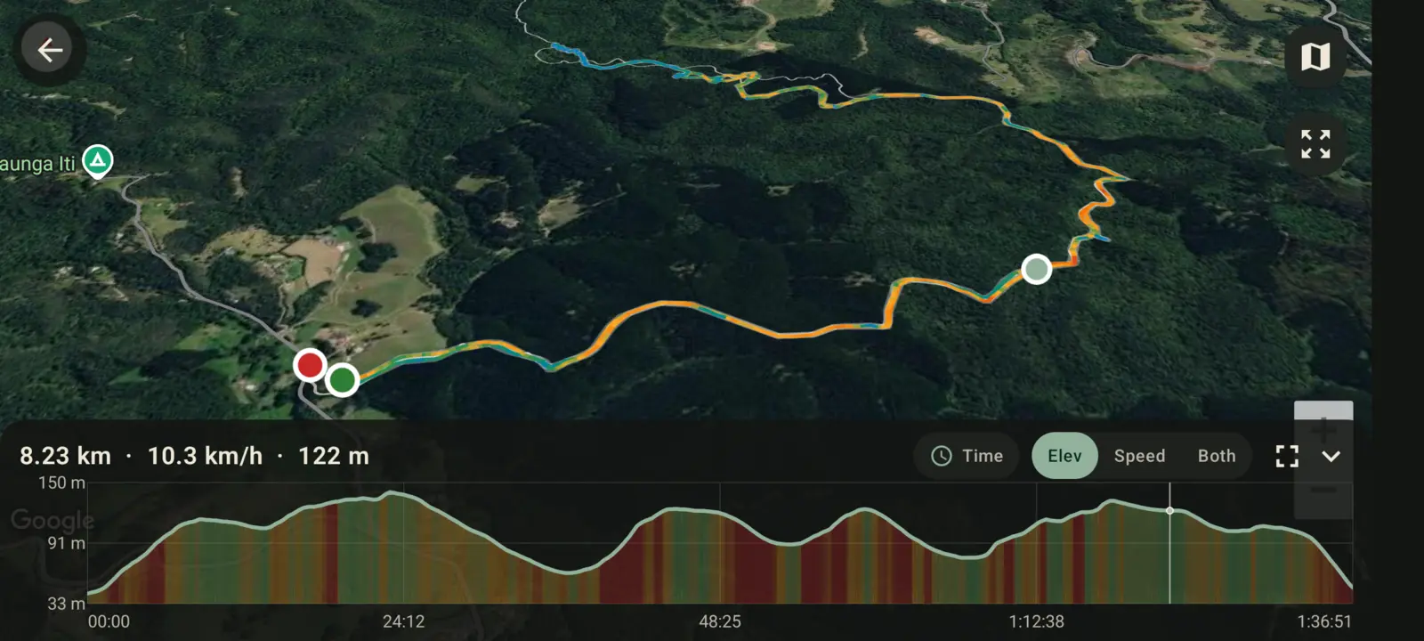
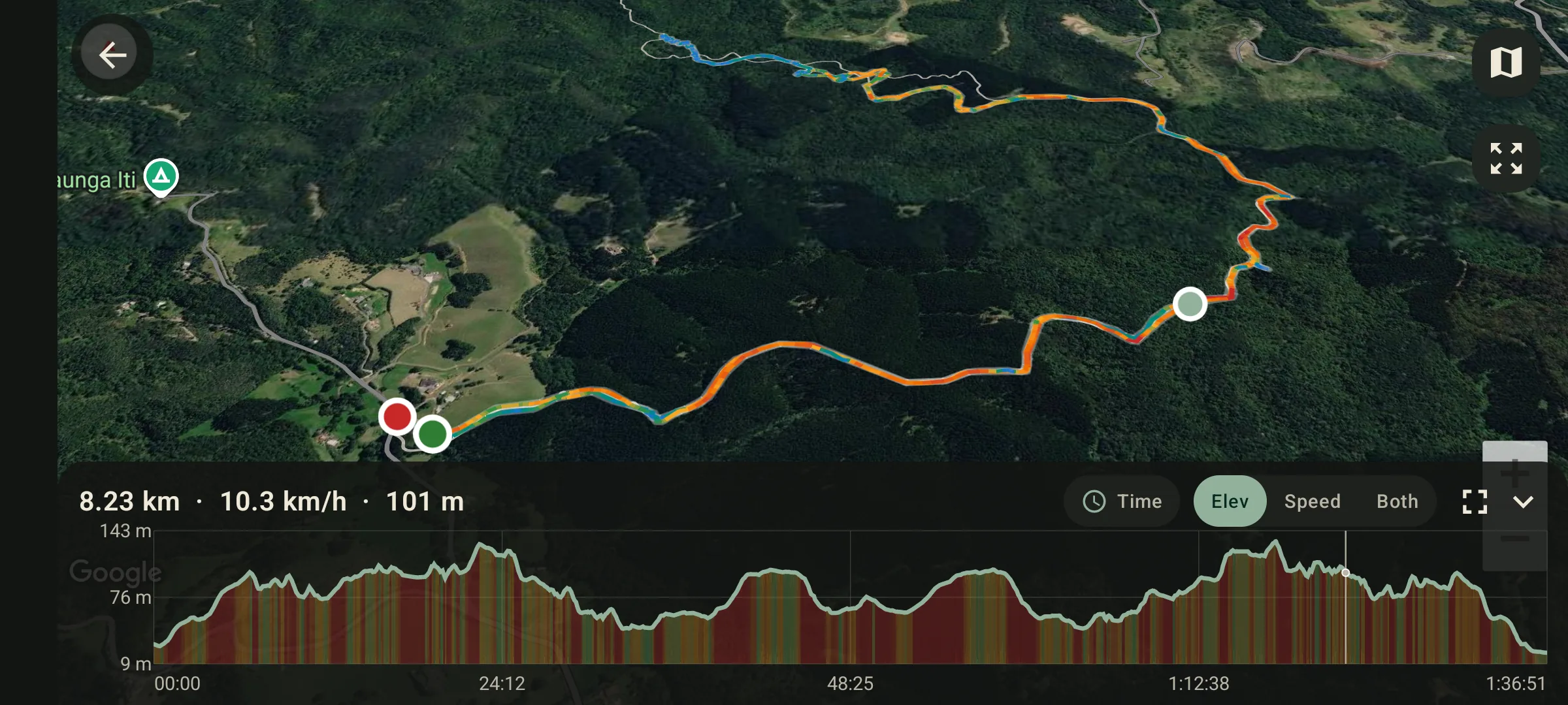
Why GPS elevation goes wrong
Phone GPS is usually much better horizontally than vertically. Latitude and longitude may be good enough to draw your path, while altitude jumps up and down because satellite geometry, tree cover, buildings, weather and phone sensors all add noise. Barometers help on some phones, but pressure changes can make a route drift even when you stayed at the same height.
That noise matters because elevation gain is cumulative. Small false climbs, repeated over thousands of points, can turn a normal route into a misleading climbing result.
What terrain correction does
Terrain correction keeps each recorded latitude, longitude and timestamp, then replaces the noisy altitude with ground elevation from a digital elevation model. GPS Logger downloads the public terrain tiles needed for the route area, samples the height for each point, and recalculates the elevation profile and gain on the phone.
This is especially useful for walking, hiking, trail running, cycling, road trips and GPX archives where you want the track to describe the land surface rather than the phone sensor's drift.
When it helps most
- A GPX track has impossible spikes or sudden drops.
- A flat commute reports too much climbing.
- Several recordings of the same route show very different elevation gain.
- An imported GPX file has missing or poor altitude values.
- You want a cleaner elevation chart for a saved route.
When terrain correction is not the right answer
Terrain data is ground height. It cannot know that you were on a bridge, inside a tower, on a ski lift, below ground, on a ferry, in an aircraft or moving through a tunnel. In those cases, the phone's recorded altitude may describe your real position better than terrain height.
How to correct elevation in GPS Logger
- Record a route or import a GPX file.
- Open the saved track from History.
- Choose Correct elevation. The app needs an internet connection to download terrain tiles for the route area.
- Wait for the correction to finish. The elevation profile and gain are recalculated from terrain data.
- Export GPX or KML if you need a corrected file for another mapping tool.
The app shows any current correction limits before you start. Batch correction is useful when you want to clean up a whole saved library rather than one route at a time.
Privacy and export notes
GPS Logger is still built around local track history: your routes are saved on your device unless you export, share live location, or use another feature that clearly sends data out. Elevation correction needs terrain-tile downloads for the route area, but it does not require an account or a proprietary GPX upload workflow.
After correction, single-track export remains portable: save the route as GPX or KML, or keep it in your private journey atlas.